Total Pageviews

Saturday, 20 January 2018

Snowy Stanage edge...A walk from Hathersage.

19/01/2018.

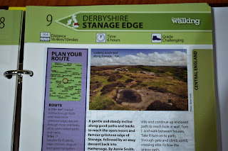
I have a book titled 100 greatest walks in Britain, thought I would try out one of the routes this week. I chose the Stanage edge walk in Derbyshire. The walk is classed as challenging, but having done most of this route before I'm sure it will be fine. At 10 miles long it says allow 6 hours. 6 hours? I'm sure it wont take that long. As we drove down to Hathersage we could see plenty of snow on the tops...Great should be a good day.


A lovely walk up the valley on paths that we rarely visit. We passed Peak and Northern sign number 262 in a lovely wooded setting below Greens house. I have been collecting photographs of these signs for many years now, I believe that there are over 500 of them scattered around the Peak district, Its always a thrill to find a new one.


Climbing quite steeply now on muddy paths we eventually made it up to the snowline. Alfie was in his element, rolling around like a lunatic. As we climbed up to Dennis Knoll the view became wider and wilder, we had well and truly left the valley now. We made it up to the lonely road up below the edge, it looked slippery, not many drivers up here today.


We left the road and followed the track that lead up towards the edge..Soon leaving this track in favour of a path near The Buck stone.The path heads Northwest keeping below the rock escarpment of High neb, there are many abandonded Millstones alongside the path here..I say alongside the path but I'm not sure if we were on the path or not as the snow was getting quite deep along here.


Something special about walking in snow, cant put my finger on it, I just love that scrunch under the boot. However this is a rocky place and a misplaced foot and you are in knee deep. Snow down your socks and inside your boots isn't so much fun. The wind was now picking up causing the snow to drift across the path. we decided to scramble up to the edge where the walking would be much easier.


We headed back along the edge to the summit trig point to High neb standing at just above the 1500ft mark This northern part of the edge forms the boundary between South Yorkshire and Derbyshire and is the highest point of the whole edge.


Its a fair distance along the edge, but with views this good you don't want it to end. Stanage [from stone edge] is a magnet for climbers as well as walkers but today we virtually had it to ourselves only seeing a couple of other walkers along it's entire length ..My camera was working overtime along here, the blue skies disappeared but I aint complaining the brooding clouds and dark skies made it even more special..I have always admired the view back to High neb, I rate it as one of the best vistas in the whole of the National park...Its in the next photograph.


We reached the end of Stanage and dropped down towards Higger tor And then taking the path downhill. Callow bank has a fine viewpoint down to Mitchell field farm. We rounded the farm and picked up another path, one I have never walked before. Its great to follow new paths from time to time..We looked back up to Callow bank and Higger tor, familiar hills, but having never seen them from this path before they appeared like new hills. I enjoyed that.


We made it back down to Hathersage. We were buzzing, I cant remember how many times I said "it was good wasn't it"...Snowy walks are always special but this one was out of this world, it certainly deserves its place in a book called Britains best walks...As for time taken I checked my tracker ....5 hours 13 minutes...Life in the old dogs yet.


Wednesday, 17 January 2018

A moorland round from Gribdale gate.

17/01/2018.

I'm looking forward to this walk I thought as I tucked into my delicious fryup that my wife had kindly cooked for me...This will set me up for the day..I am heading up to Great Ayton on the edge of the North York moors to meet up with my old bud Keith, who will be joining me on todays walk. Not seen the old bugger for a while so it will be good to catch up...I arrived at Great Ayton a little early so I had a walk around the village..Its a most attractive place with the River Leven flowing through the centre. I could see the familiar sight of Roseberry topping peering down on me above the village rooftops. A most attractive hill...A mini mountain.


Great Ayton is known as the village that the famous explorer and navigator Captain James cook spent his childhood years. There is a statue of him on the village green...Keith turned up and we decided to drive up to Gribdale gate to start the walk...Its a popular starting point for walks situated along the Cleveland way..A steep start Through woodland and we soon had another view of Roseberry Topping, it only just breaks above the 1000 ft mark but this distinctive little peak demands attention.


Up on Easby moor we came to the well known landmark of Captain Cooks monument. It certainly is a great viewpoint with panoramic views towards the Cleveland hills..How lucky the people of Stockton and Middlesborough are to have this on their doorstep...We hadn't really planned a route for todays walk we just kept going and see where it led.


We headed down to Kildale, a quiet backwater. That's what I love about the North York moors, so many quiet valleys.


From the shelter of the valley we headed back up to the moors and followed the track along Percy cross rigg, freezing cold up there. We came across some interesting old Hut circles, must have been a hard life up there in winter. I had 2 hats on, gloves, Thermal underwear and several layers and I was frozen, cant imagine how these souls survived up there living in a crude mud hut dressed in animal skins..We stopped for a sarnie and I could of cried as my hands were so cold...


We didn't stop long..As the next point of interest on the walk was to be The Hanging stone. This huge graffiti covered rock looks out across The town of Guisborough towards the North sea.

This view was probably the highlight of the walk for me..we stood for quite a while...looking around...after a while it was back across Newton moor. Another view of Roseberry topping loomed ahead..do we or don't we?...we decided against it 


Well we are in our mid 50s...9 miles was enough so we headed back down to Gribdale...Its been a good day..Had a good catch up..conversations about Bakeries, Avocets, Wild camping, Dogs, Dusty Redstarts, The Cleveland way, Running, Petches pies, Lake district, Holidays, Hartlepool, The weather, Ray mears, hills...donkeys and Mo Farrah.


Tuesday, 9 January 2018

Upper Burbage, Higger tor and Hathersage moor.

7/01/2018.

This is a walk we return to again and again, I suppose when I think about it our favourite...Whenever we can't decide where to go, we always choose Higger tor. Tends to get a bit crowded though due to its proximity to Sheffield, but the views and marvellous countryside more than compensate. A beautiful cold crisp morning as we pulled into the car park at Upper Burbage bridge. These are the best days of all. Gloves and hats on we set off towards Higger tor. Luckily the muddy track was frozen solid making life far easier, theres nowt worse than slipping and sliding along a muddy path. There were some great intricate ice patterns in the frozen puddles....Quite an artist that Jack frost.


Gloves came off to take a few photographs [ which I soon regretted as it was so flippin cold ]. Never mind the short climb up to Higger tor will soon warm us up. Standing at around the 1400ft mark we stood to take in the wide ranging views down to the Hope valley. Nearby in the Upper Burbage valley stands the little rocky top of Carl wark, the site of an old hill fort and well worth a visit. Not for us today though as we headed off in the direction of Over Owler tor.


We arrived at Over Owler a wonderful rocky little hill, a popular spot for all the family. It is usually a busy place being a short walk up from the Surprise view car park. There are some great gritstone rocky features to take photographs off. Heres one I took looking back towards Higger Tor with Stanage edge of the left.


We bobbed along feeling great...there is a lot to be said for taking a walk..Walking is a mans best medicine, when the countryside is this lovely all else is forgotten..leaving Over owler we passed Mother cap, a huge Gritstone rock that can be seen for miles around. I remember a few years ago watching an Asian chap up there with his prayer mat. Praying in the direction of Mecca. No one up there today, certainly not me as I have been stuck up there before, looking like a proper Charlie.


From here its down to Burbage brook, Alf had his customary dip. He never feels the cold, I have known him to break through the ice to have a swim.


Heading back now along the track below Burbage rocks, love the views along here towards Carl wark and Higger tor. Mid day now but the path was still very icy, I lost count of the number of times I saw people slip almost arse over tit. Including myself.


So that's another walk finished, a lovely little half day march. I'm feeling good about this years walking.


Monday, 1 January 2018

Alport Castles from Ladybower

31/12/2017.

The last day of 2017, we wanted to finish the year on a high. I suppose it hasn't been a bad year for walking, although we have only managed to clock up around 650 miles. A few of the years highlights have been The Calf, Buttermere, Smearsett scar, Harter fell and Ben Lomond, all great walks. I say that we wanted to finish on a high,well we certainly did, as todays walk was a real cracker. I nice early start from Ladybower reservoir..


Up up through the woods, we soon found ourselves up on Rowlee pastures. Great views of the Woodland valley from up there, don't know why it is called that. we gazed across the valley to the northern wall of Kinder scout. So windy up there today, even the Ravens were having trouble with flying. I quite enjoyed being buffeted around by the strong wind.


The path changed direction and with the wind now behind us we were blown along at speed in the direction of Alport castles. I loved the moorland colours up there, the grasses always look their best in the winter. In the distance there was a sprinkling of snow up on Bleaklow,hanging around from the snows earlier in the week.


We planned to drop down into Alport dale from here but first we detoured to have a close look at Alport castles..A real spectacle that never fails to impress I stood on the rim looking out across to the tower. There is no castle here as the name suggests, just a huge landslip. Its an amazing place,half a mile long it is said to be the largest landslide in the British isles. The name Castles comes from the debris scattered along the slopes of the hill. There are several gritstone mounds that really do resemble castles. The largest of these is called The Tower and it really does look like a full scale Motte and Bailey castle.


A most strange,but beautiful light up there this morning, Rain swept in and I never got any good photos, never mind, I'm sure that this will not be my last visit to this magical place. We retraced our steps to find the path that skirts around the edge of the Landslip. We looked back often and bugger me the sun came out and the rocks looked far more cheerful, I toyed with the idea of going back up for a photograph..Nah, we kept to the path dropping down into the valley.


Down in the valley it dawned on me that I had only ever been here once before. Its a lovely valley with only a couple of buildings along its length Alport castles farm sits in a remote spot beside the Alport river. Apart from walkers that come to see the castles, no one visits the Dale, must be heavenly to live here, with just the sheep and wildlife for company.


I enjoyed every step along the valley. So much to see, so much to admire There are many beautiful places in the Peak district and we all have our favourites. But The Alport valley on this beautiful sunny December morning knocked me for six....I was smitten.


We left Alport dale at Alport bridge and entered the woodlands valley, not half as pretty but enjoyable all the same. We stopped for something to eat here in a sheltered lane. lovely Cheese and pickle sandwichs washed done with Hot Chocolate... "who made this Hot chocolate its disgusting"..oh yeah it was me...Water will suffice.


It was all uphill again as we climbed up to the ridge that seperates the Woodlands valley and Ladybower reservoir. Suddenly lots of people about, we decided to go straight back to the car giving the crowds at Fairholmes a wide berth...Well that's another walk done, a great way to end the year...I wonder what next year will bring....hopefully more of the same.