Total Pageviews

Thursday 7 December 2017

Bretton clough.

03/12/2017

With only a few hours to spare we chose another short walk. This time we would be taking in Eyam moor, Stoke ford, Abney and Bretton clough...Parking high up, on the Bretton side of Sir William hill would save us the climb up from Eyam. It would also mean that we will have fantastic views for the whole round. A sharp cold wind as we set off up the track to Eyam moor. Its a most interesting little tract of moorland, littered with Ancient cup marked stones, a place that would have been alive with Druids in times passed, there are also a couple of Stone circles up there. I will return one day for a more leisurely perusal. Its also a grand view point looking out across the valley of the Derwent towards the Edges of Froggatt and Curbar.


The path drops gently down from Eyam moor heading for Stoke ford, I have always loved this path, there are some nice views into Bretton clough as the path hugs the edge of the valley, this is a great place to sit [ in Summer] and soak it all in.


We dropped down to Stoke ford on a muddy/slippery path to cross the stream via a footbridge. This is another popular place for walkers to stop, have a sit down and open the flask and the snap box, not today though as we pressed on up along Abney clough.


Abney clough has been wooded for many years, but all has changed recently as the Japanese Larch plantation that covered the slopes of the hill have reached maturity and are currently being felled. Always an eyesore to see freshly cleared woodland but things must move on . The Woodland will be replaced with native trees including 50% Oak along with Birch and Alder.


We slipped and slithered along the muddy path up to the small village of Abney. A quiet,out of the way little village where nothing really ever happens, just my sort of place. In Old English Abney is known as Abbas land, I half expected to see Benny pop his head up from behind a walk to say "Hi" but we saw not a soul, just a few barking farm dogs... Leaving the village we headed towards Bretton clough.


Bretton clough was beautifully quiet, the only noise came from my panting as we climbed out of the valley. Lovely views back  towards Abney low..It hasn't always been a quite place though as it is documented that the local farmers once hid their cattle in this valley from Bonnie prince Charlie and his Highlanders as they invaded Derbyshire on their way south..


We reached the small hamlet of Bretton, with its lovely old pub called The Barrel, a traditional Derbyshire country inn dating back to 1597. Standing at some 1300 feet above sea level the pub claims to be the highest in Derbyshire. Sadly not yet open as we passed by today, shame as I could have murdered a pint.


Just a hop, skip and a jump back along the road now to the car. There are some nice views along here looking out across towards the White Peak area of Derbyshire....A short but sweet 5 miles. Nothing much happened but I enjoyed everystep.


Monday 27 November 2017

A wander up Win hill.

26/11/2017

Another short walk today of around 5.5 miles..I remember years ago we wouldn't have gone out for anything under 10 miles but these days 5 or 6 miles is just right. In those days we used to race around clocking up miles, but now we take our time and enjoy the slower pace, Some things just can't be rushed. It's late November now and winter seems to have arrived..Horray, I love winter, the best season of all...We had heard that there was a good chance of snow on the hills today, I really hoped so as snowy walks are always the best...days you don't forget. We drove out of Sheffield hoping to catch a glimpse of the white stuff. Then as we passed Moscar, Win hill came into view, just a dusting,never mind...We parked up by The Yorkshire bridge pub and set off along the Ladybower Dam.


A popular place is Ladybower, superb scenery and the starting point for so many good walks. Built between 1935 and 1943 by the Derwent valley water board to supply the water needs of the East Midlands. We chose to ascend Win hill via the Parkin clough path, I don't know why we decided on this route as it is possibly the worst route up, being a steep and muddy treadmill up through the woods.


There are no views, just a steep scramble. I got to thinking of all the other routes up Win hill, there are probably another 7 or 8 main routes up to the summit, all of them better than this route. I like the route up from Hope railway station via Aston or the steep path from Twitchell farm, There are so many routes up to Win hill, one of the Peak district finest summits.


We finally left the trees behind, things should get much better now. From here there is a well constructed path up to the summit. it always amazes me that when you find a lovely stepped path that the ground on both sides of it are terribly eroded, why would you walk beside a path?..At the top we were suddenly treated to the view Northwards to the snowy hills of the Dark peak..Mam tor, Lose hill, Kinder scout and Bleaklow all gleaming white, would have loved to have been up there on Kinder today.


The summit of Win hill stands at 1519ft, or if you prefer 463m..never been one for metres myself. Its like Kilometers, it makes me laugh when I hear people say how many kilometres they walked...it means nowt....it will always be feet and miles for me...We left the summit, known by some as Win hill pike or the Pimple. I have also heard that it was once known as Old Witches Knoll...I love these old names for our hills.


We carry along following the path to Hope cross. The weather was superb with some great views across the valley. Lose hill was looking her very best.


We never made it as far as Hope cross as we turned off right into the woods near Wooler Knoll, a path we had never walked before..Some nice views across to Crook hill from here. We soon went astray following a sketchy path that turned out to be a mountain bikers track through the woods, lots of twists turns and jumps. Those bikers are crazy dudes...As long as we kept heading downhill we will reach the main path around the reservoir..and yes it eventually turned up. Its a nice track alongside the reservoir, a path we have walked dozens of times before. I thought back to the time I walked along here with my daughter Emma a few years back...I will never forget it. we came to a sheep grazing and as we passed it turned towards us. Shock horror.!! it didn't have a face. I think it had probably been hit by a car, it had no eyes just a black head  that looked like dryed blood...It was horrific.....Anyway nearly back to the car..We passed the reservoir overflow and realised how low the water level was. everyone stops for a photograph here.


Well that was another walk over...roll on the next one.


Sunday 5 November 2017

A saunter down to Padley.

05/11/2017.

I found myself with a free Sunday, so we decided not to waste it. We wanted just a short walk, not too far from home, so we Choose a walk from the Fox house, a few miles out of Sheffield. Bloomin freezing as we got out of the car and set off. Contary to popular belief the Fox house was named after Mr Fox of Callow farm in Highlow and not the small cuddly animal that can be seen on the pubs sign. Dating back to 1773 the Fox house was once the favoured resting place for livestock drivers and stagecoach passengers...We might have a pint on return we said.


Its a popular place to start a walk, an early start is recommended to bag a parking spot. We headed downhill towards the Burbage brook, photographers were out in force, hoping to make the most of the late Autumn colours. The trees will be stripped bare soon and winter will be here, The Queen of all seasons. I always look forward to winter. We followed the Brook down to the top of Padley gorge.


Hoping to take some nice photographs as we walked down the gorge, but the sun disappeared and it became quiet gloomy.We kept moving, wet and sqelchy underfoot. At Padley we passed the Old mill a most attractive old building once a water powered corn mill, now a private dwelling.


Shortly we passed Grindleford station café, too cold to sit outside for a cuppa today but its a cracking place, popular with both Walkers and Bikers. Well known for it's fryups.


Uphill now, time to Gird our loins [prepare ourselves for action]. Actually it wasn't that steep although I found I did have to take my hat off and mop my brow at one stage. Good to get out of the trees to feel the breeze. We paused to look back over the valley of the Derwent towards Sir William Hill. Very nice.


Moorland all the way now  we carried on uphill to White edge lodge, standing alone on a vast expanse of Heather moorland. it's dramatic location is due to its former use as a gamekeepers cottage, today it is owned by The National Trust and is available to hire as a holiday cottage...bet its an expensive place to stay.


We crossed the busy road to visit the Wooden pole, A pole has stood here for hundreds of years, the pole was depending on which source you prefer either a boundary marker or a guide post on an old Packhorse route. There is another one of these a few miles away near Stanage edge. The post is replaced periodically by the National Trust.


We kept to the high ground to take in the views, we were now on the Longshaw estate, looked after by The National Trust its a popular spot with Walkers and families..can get very crowded at times. Especially around the Tearoom. Shall we  have cup of tea here or a pint at the Fox house?..We opted for Tea.


Really enjoyed todays walk, could have walked forever...I looked at the route planner on my phone, it had only been 4.7 miles but it had taken us 3 and a quarter hours...Its so nice to slowdown and walk slowly, take it all in.....I maybe a slow walker, but I never walk backwards.


Tuesday 31 October 2017

A wet day on Ben Lomond.

25/10/2017.


The highlight of our Holiday in Scotland was to be the climbing of a Munro...But which one? We have plenty to pick from, I have only conquered 22 of them in the past. As we are staying in the Loch Lomond and the Trossachs national park it had to be no other than Ben Lomond. Its a popular hill, as its the most southernly of the 282 Munros, being close to Glasgow and the built up areas of central Scotland. Standing at 3196ft, I have read somewhere that the summit attracts around 30,000 people every year...I hoped it wasn't going to be too busy today..We chose today for our walk as we have been checking the weather forcast and all weathermen informed us that today was going to be the best day of the week..so here we go.


Parked up at Rowardennan, nice and early we set off along the Tourist path,apparently its quite an easy climb on a decent path all the way to the summit..On reaching the summit we would then return along the entertaining Ptarmigan ridge. The walk starts through beautiful ancient Birch and Oak woodland. We climbed steadily through the trees and then suddenly we were treated to our first view of the Ben.


It was up there somewhere, head in the clouds, just as you would expect for a biggy. We soon freed ourselves of the trees , grand views were beginning to open up behind us, looking back over the Loch...It was along here that we passed a strange looking chap.He was wearing a huge coat that came down below his knees,Hood up, head down. In his hand was a Co-op carrier bag containing several bottles of pop and what looked like a road atlas...he grasped onto this bag with the largest pair of motorcycle gloves you have ever seen...He walked weirdly too, sort of on tip toes..As we passed him I said morning...he looked at me with hollow eyes,but said nothing. I assumed he was a drug addict, trying to clean his mind in a way that only mountains can...Anyway he was soon left behind. I looked back often until he was just a spot in the distance.


Drizzly rain came and went, I remember swearing about the weather man. After a steep section we made it out onto a plateau, and suddenly there it was in front of us, the summit that we had come to climb, still in the clouds but we got a good idea of what we still had to ascend..Spoke to a Dutch family along here with two young boys..the boys seemed to have had enough,..being buffeted about by really fierce winds I said to the Dutchman that this was supposed to be the best day of the week..He laughed like a drain although I had the feeling he didn't know what I had said..


Its a bit of a long dull trudge if the truth be told...and any excitement is held back until we neared the summit. Soaked through to the skin now as the zip had broken on my jacket, gloves came out for the first time this year, putting them on was a struggle ,cold and wet I shouted at the rain, I believe I called it an arsehole at the top of my voice..


The low cloud came and went, then came and went again. Spoke to a couple from darn sarf..They said Alfie didn't look very happy, he has seen worse I said as I pulled him back down to earth by his lead after a strong gust lifted him of his feet.


Well we made it to the summit, heres a picture of the missus and dog to prove it. That's 23 Munros in the bag...I thought about the first person to climb the Munros, I believe he was a vicar called A E Robertson in 1901. I vaguely remember a story that on completing his round of Munros he kissed the summit cairn and then his wife...No kissing today. We peered over the edge looking down to the Ptarmigan ridge, you're not getting me down there in this weather said the missus. So we tucked our tails firmly between our legs and returned the way we came...That long trudge back down seemed like a nightmare, my foot was hurting and we were cold and wet...but looking back now, I cant wait to do it all again...pain is soon forgotten...Halfway down we came across Co-op bag man, still head down, still on tip toes...I didn't bother saying hello in case he killed me. My camera stayed in its bag on the way down.. as we made it down to the trees, our old friend the Sun made a brief appearence 


Typical.


Saturday 28 October 2017

Two Scottish tiddlers

Ben Aan and Conic hill.

October 2017.

Been up to Scotland for the week to chill out in a wonderfully remote cottage on the southern shores of Loch Katrine near Stronachlachar......Early in the week we walked to the tops of two lovely little hills..Firstly came Ben Aan, a popular little hill smack bang in the middle of the Trossachs national park.. Rising to a height of 1512ft, the summit cone stands proud looking out across Loch Katrine and Loch Achray


I believe the walk was 3 miles long from Loch Achray, perfect for a short morning walk...A bit dull and grey as we set off, hoping the forcasted rain would keep away until we returned. Some lovely Autumn colours around the Trossachs at the moment, as you can see from the next picture taken on the lowers slopes of the hill.


The colours of Autumn were not to last though as much of the southern side of the hill has undergone extensive felling..The lack of trees made the summit cone stand out even more prominently...How the hell are we going to get up there we thought.


It turned out to be a simple, though steep climb up a well made path up to a notch on the right of the summit. As we climbed we were treated to good views across to neighbouring Ben Venue..Maybe a hill for later in the week we thought.We reached the summit via a short scramble of the summit rocks, looking out across Loch Katrine we could see the rain rushing in towards us so we didn't stay long. After a couple of photographs we retraced our steps back to the car.


A shame we didn't get much of a view but that's what hillwalking is all about, some you win and some you lose. The views are why we do it I suppose...On our way back down we met about 100 people from all nations..we stopped to pass the time of day with lots of them, there were Americans, Indians, Polish, Scottish, English, Chinese, Dutch and even Geordies...It was a nice walk that I would award 7 out of 10....

A couple of days later we found ourselves on another busy little hill...This time Conic hill from the village of Balmaha on the eastern shores of Loch Lomond...Its a knobbly little fella with smashing views out across the loch to the west, while to the south we looked across to the Campsie fells, known as the sleeping giant.


An interesting feature of the hill is that it sits right on the line of the Highland boundary fault, where the highlands meet the lowlands...some strange rocks up there...Another reason for its popularity is the fact that the West Highland way long distance path crosses over it..It never had the crowds that we encountered on Ben Aan but it was still a very popular hill.


Spoke to a fella from the Netherlands on top, he was blown away with the great views, he explained how flat Holland was and that he was chuffed to have made it up to the summit of Ben Lomond...I didn't want to, but I had to burst his bubble telling him that this wasn't Ben Lomond...I pointed it out, several miles distant, its head in the clouds as usual. I told him it was about three times the height of this little hill..i feel I may have just spoilt his holiday as he trudged off looking disappointed.


We followed a ridgeline back down to Loch Lomond, looking back often at this most attractive looking hill...Its only 1,184 ft high but it seemed much higher than Ben Aan did and totally different in character...


Back down to sea level we enjoyed a walk back along the loch shore to Balmaha where a much needed pint hit the spot.


Monday 16 October 2017

Discovering Little Fryup dale.

15/10/2017.

I fancied the Lake district this weekend but what with all the rain they have had up there I decided against it. The North York moors looked like the best shot for decent weather. I always check the weather, don't know why? there's nothing I can do about it, I suppose it's just what the English do, we all love the weather,don't we?..It looked good, nice and sunny with temps in the low 20s. I was looking forward to the nice drive over the moors from Hutton le hole to Castleton..What a joke, viability was down to about 50 yards as we crawled along at 25 miles an hour. Good job that the lines in the middle of the road had been freshly painted...We eventually made it down to Eskdale and to the starting point for todays walk, The Moors centre at Danby lodge. What's with all the people I said as we pulled into the car park...Dozens of miserable looking people jumping around on the spot, doing stretches, There was some sort of running event on...Serious people those runners, never seen one crack a smile..i had hoped to have a look around the visitors centre but with all these people around we just wanted to get started...get away from it.


Todays walk was going to take us up into Little Fryup dale, a place I have never walked before. I like the name Fryup, it is said to derive from the old English Fring.hop. Fring was an Anglo Saxon goddess and Hop denotes a small valley. We never saw Fring today in fact we only saw one other person during the whole walk, which is just how I like it.


We hadn't been walking long before we came to Duck bridge. This sturdy,high arched bridge is a fine example of a 14th century Packhorse bridge. It was originally known as Danby castle bridge until it was repaired in 1715 by a George Duck hence its present name..Apparently it remained open to traffic until 1993. I doubt many of todays cars would be small enough to pass over it.


Just up the lane from the bridge we came to another 14th century gem, the remains of Danby castle sitting on a spur overlooking the Esk valley. It was built for local lord of Danby, Lord Latimer as a sign of his great wealth. It is also well known that Catherine Parr once lived her, Henry VIIIs sixth and last wife. Today the castle is open to visiting groups by appointment only. It is also a venue for weddings.


Such a quite valley, with just a handful of farms along it's entire length. I was enjoying the walk although I kept looking up to the high ground wishing I was up there. We could see a few people moving at speed along the ridge, probably miserable runners I thought...The cows in the valley looked happy munching away at the lush green fields, they made me happy they hardly bothered looking up as we passed by.


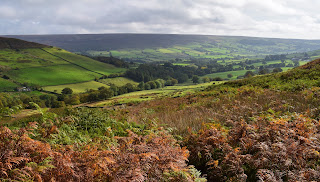
We picked up a lane which we were to follow up the valley toward Fairy cross plain, and the hills at the head of the valley. Fairy cross plain is another strange name, I have read that Fairies are said to live by a stream up there somewhere. The small round hill on the left in my picture is marked on the map as Round hill, centuries ago it was known as fairy hill...I find these old tales of folklore really interesting...What's wrong with believing in fairies?


A little further on and we spotted a molecatcher's Gibbet. I counted 98 moles hanging on barbed wire fences.Once a common sight but something you don't see much of these days, part of farming life. The molecatcher will hang his catches up to show the landowner that he is doing his job. This chap has certainly been busy. Over the years I have seen other examples of this behaviour I have seen Rats hanging or more commonly Rooks and Crows.


At last we made it up to higher ground on the slopes of Heads..It was here we stopped to eat, sitting looking out over the emerald green fields in the valley. The views from up there were the highlight of the walk for me. I enjoy all walking but it's always best to get onto the hills rather than looking up at them.


We traversed along the top of Danby crags before dropping down and doubling back on ourselves to pass though Crag wood.. Some lovely autumn colours on display as we passed through the woods...A bit muddy in places though [which pleased the dog].


Back down in the valley we came to the River Esk where we decided to clean the dog off [which pleased the dog]..All that was left now was to follow the quiet lane back to the start...I looked back to the dale often...it had been a good walk with some outstanding views, roll on the next one.


Saturday 30 September 2017

Farndale and Rudland rigg.

30/09/2017.

Fancied something a bit different this weekend, somewhere new..We don't visit the North York moors enough I thought, so with this in mind I found a lovely little walk of 6 miles in Farndale..Now I had heard of Farndale, as it is a place famous for Wild Daffodils..These Wild Daffodils have heralded spring in this valley for centuries. Known locally as Lenten Lillies since their flowering often coincides with Easter. Some say many were originally planted by the monks of Rievaulx abbey.Dont know how true that is but I knew that there will be no Daffodils in the valley today...maybe we can come back next spring to see them.


Didn't get up until 7.30, so we never had the early start that I like to have...never mind, we pulled into the car park at Low mill around 10ish..nice and quiet, just how I like it...I felt like a kid in a sweetshop, hills reared up in all directions. We headed north up the valley. The Horns ridge looked exceptionally attractive.


We couldn't help noticing how many Pheasants and Partridges there were in this valley, obviously reered for shooting..As we passed Horn End farm we witnessed the slaughter first hand as there was a shoot going on along the hillside..Beaters waving flags while the gunmen picked them off one by one..End of the road for a hundred or so beautiful creatures. That's life in the country....We climbed steadily up towards the moorland of Rudland rigg, looking back often...No more gunshots although we could see the murderers heading back down to their flashy 4x4s.


At The top we came to the wide track along the ridge of Rudland rigg. This is a popular place for off road motorbikes although we never saw any, we did however see a young farmer on his quad bike, Collie balanced on the back..he pulled over for a chat, I told him what a great life he has, working up here on the high moors. Not so good in winter he said when you often have to dig sheep out of the snow. Before he went on his way he told us to watch out for off roaders as they often shower walkers with stones as they rip past..i do believe he called them Bastards....I like him, could have chatted for hours.


We saw him again a bit later on, stood looking out across Farndale...yeah lucky man I thought again.


We were dropping down steeply now back towards the valley. We enjoyed the entertainment as we watched a small aeroplane doing stunts, looping the loop and twisting and turning like a lunatic [ don't try this at home kids]. Even the sheep were looking upward.


These bleak, windswept moors and isolated valleys emphasise the elemental forces of nature, and it is hardly surprising that beliefs in the supernatural and the other world have been strong in these tight-knit dale communities, stories of hobgoblins abound. There are many stories of farmers who have fled the valley to escape the mischief of these little tormentors...all the farms we passed seemed so quiet..I wondered if the little goblins were still up to no good.


Back down in the valley and all that was needed was to follow the path alongside the River Dove back to Low mill. Really beautiful finish to such a lovely walk..Cant belive we haven't visited before.