Total Pageviews

Tuesday, 31 October 2017

A wet day on Ben Lomond.

25/10/2017.


The highlight of our Holiday in Scotland was to be the climbing of a Munro...But which one? We have plenty to pick from, I have only conquered 22 of them in the past. As we are staying in the Loch Lomond and the Trossachs national park it had to be no other than Ben Lomond. Its a popular hill, as its the most southernly of the 282 Munros, being close to Glasgow and the built up areas of central Scotland. Standing at 3196ft, I have read somewhere that the summit attracts around 30,000 people every year...I hoped it wasn't going to be too busy today..We chose today for our walk as we have been checking the weather forcast and all weathermen informed us that today was going to be the best day of the week..so here we go.


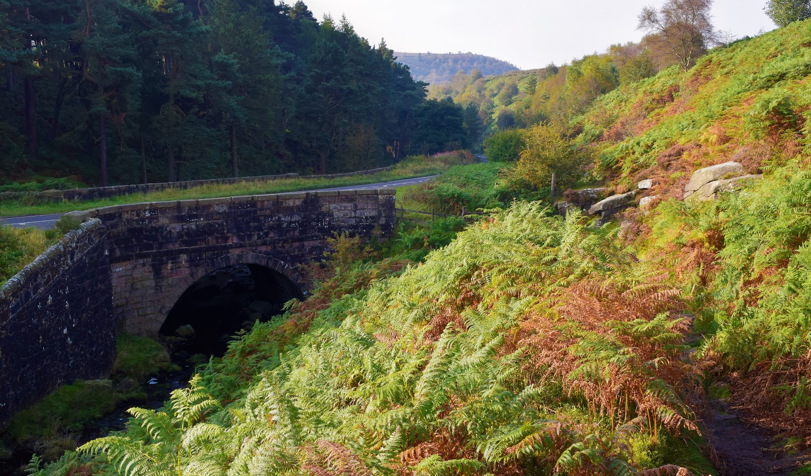
Parked up at Rowardennan, nice and early we set off along the Tourist path,apparently its quite an easy climb on a decent path all the way to the summit..On reaching the summit we would then return along the entertaining Ptarmigan ridge. The walk starts through beautiful ancient Birch and Oak woodland. We climbed steadily through the trees and then suddenly we were treated to our first view of the Ben.


It was up there somewhere, head in the clouds, just as you would expect for a biggy. We soon freed ourselves of the trees , grand views were beginning to open up behind us, looking back over the Loch...It was along here that we passed a strange looking chap.He was wearing a huge coat that came down below his knees,Hood up, head down. In his hand was a Co-op carrier bag containing several bottles of pop and what looked like a road atlas...he grasped onto this bag with the largest pair of motorcycle gloves you have ever seen...He walked weirdly too, sort of on tip toes..As we passed him I said morning...he looked at me with hollow eyes,but said nothing. I assumed he was a drug addict, trying to clean his mind in a way that only mountains can...Anyway he was soon left behind. I looked back often until he was just a spot in the distance.


Drizzly rain came and went, I remember swearing about the weather man. After a steep section we made it out onto a plateau, and suddenly there it was in front of us, the summit that we had come to climb, still in the clouds but we got a good idea of what we still had to ascend..Spoke to a Dutch family along here with two young boys..the boys seemed to have had enough,..being buffeted about by really fierce winds I said to the Dutchman that this was supposed to be the best day of the week..He laughed like a drain although I had the feeling he didn't know what I had said..


Its a bit of a long dull trudge if the truth be told...and any excitement is held back until we neared the summit. Soaked through to the skin now as the zip had broken on my jacket, gloves came out for the first time this year, putting them on was a struggle ,cold and wet I shouted at the rain, I believe I called it an arsehole at the top of my voice..


The low cloud came and went, then came and went again. Spoke to a couple from darn sarf..They said Alfie didn't look very happy, he has seen worse I said as I pulled him back down to earth by his lead after a strong gust lifted him of his feet.


Well we made it to the summit, heres a picture of the missus and dog to prove it. That's 23 Munros in the bag...I thought about the first person to climb the Munros, I believe he was a vicar called A E Robertson in 1901. I vaguely remember a story that on completing his round of Munros he kissed the summit cairn and then his wife...No kissing today. We peered over the edge looking down to the Ptarmigan ridge, you're not getting me down there in this weather said the missus. So we tucked our tails firmly between our legs and returned the way we came...That long trudge back down seemed like a nightmare, my foot was hurting and we were cold and wet...but looking back now, I cant wait to do it all again...pain is soon forgotten...Halfway down we came across Co-op bag man, still head down, still on tip toes...I didn't bother saying hello in case he killed me. My camera stayed in its bag on the way down.. as we made it down to the trees, our old friend the Sun made a brief appearence 


Typical.


Saturday, 28 October 2017

Two Scottish tiddlers

Ben Aan and Conic hill.

October 2017.

Been up to Scotland for the week to chill out in a wonderfully remote cottage on the southern shores of Loch Katrine near Stronachlachar......Early in the week we walked to the tops of two lovely little hills..Firstly came Ben Aan, a popular little hill smack bang in the middle of the Trossachs national park.. Rising to a height of 1512ft, the summit cone stands proud looking out across Loch Katrine and Loch Achray


I believe the walk was 3 miles long from Loch Achray, perfect for a short morning walk...A bit dull and grey as we set off, hoping the forcasted rain would keep away until we returned. Some lovely Autumn colours around the Trossachs at the moment, as you can see from the next picture taken on the lowers slopes of the hill.


The colours of Autumn were not to last though as much of the southern side of the hill has undergone extensive felling..The lack of trees made the summit cone stand out even more prominently...How the hell are we going to get up there we thought.


It turned out to be a simple, though steep climb up a well made path up to a notch on the right of the summit. As we climbed we were treated to good views across to neighbouring Ben Venue..Maybe a hill for later in the week we thought.We reached the summit via a short scramble of the summit rocks, looking out across Loch Katrine we could see the rain rushing in towards us so we didn't stay long. After a couple of photographs we retraced our steps back to the car.


A shame we didn't get much of a view but that's what hillwalking is all about, some you win and some you lose. The views are why we do it I suppose...On our way back down we met about 100 people from all nations..we stopped to pass the time of day with lots of them, there were Americans, Indians, Polish, Scottish, English, Chinese, Dutch and even Geordies...It was a nice walk that I would award 7 out of 10....

A couple of days later we found ourselves on another busy little hill...This time Conic hill from the village of Balmaha on the eastern shores of Loch Lomond...Its a knobbly little fella with smashing views out across the loch to the west, while to the south we looked across to the Campsie fells, known as the sleeping giant.


An interesting feature of the hill is that it sits right on the line of the Highland boundary fault, where the highlands meet the lowlands...some strange rocks up there...Another reason for its popularity is the fact that the West Highland way long distance path crosses over it..It never had the crowds that we encountered on Ben Aan but it was still a very popular hill.


Spoke to a fella from the Netherlands on top, he was blown away with the great views, he explained how flat Holland was and that he was chuffed to have made it up to the summit of Ben Lomond...I didn't want to, but I had to burst his bubble telling him that this wasn't Ben Lomond...I pointed it out, several miles distant, its head in the clouds as usual. I told him it was about three times the height of this little hill..i feel I may have just spoilt his holiday as he trudged off looking disappointed.


We followed a ridgeline back down to Loch Lomond, looking back often at this most attractive looking hill...Its only 1,184 ft high but it seemed much higher than Ben Aan did and totally different in character...


Back down to sea level we enjoyed a walk back along the loch shore to Balmaha where a much needed pint hit the spot.


Monday, 16 October 2017

Discovering Little Fryup dale.

15/10/2017.

I fancied the Lake district this weekend but what with all the rain they have had up there I decided against it. The North York moors looked like the best shot for decent weather. I always check the weather, don't know why? there's nothing I can do about it, I suppose it's just what the English do, we all love the weather,don't we?..It looked good, nice and sunny with temps in the low 20s. I was looking forward to the nice drive over the moors from Hutton le hole to Castleton..What a joke, viability was down to about 50 yards as we crawled along at 25 miles an hour. Good job that the lines in the middle of the road had been freshly painted...We eventually made it down to Eskdale and to the starting point for todays walk, The Moors centre at Danby lodge. What's with all the people I said as we pulled into the car park...Dozens of miserable looking people jumping around on the spot, doing stretches, There was some sort of running event on...Serious people those runners, never seen one crack a smile..i had hoped to have a look around the visitors centre but with all these people around we just wanted to get started...get away from it.


Todays walk was going to take us up into Little Fryup dale, a place I have never walked before. I like the name Fryup, it is said to derive from the old English Fring.hop. Fring was an Anglo Saxon goddess and Hop denotes a small valley. We never saw Fring today in fact we only saw one other person during the whole walk, which is just how I like it.


We hadn't been walking long before we came to Duck bridge. This sturdy,high arched bridge is a fine example of a 14th century Packhorse bridge. It was originally known as Danby castle bridge until it was repaired in 1715 by a George Duck hence its present name..Apparently it remained open to traffic until 1993. I doubt many of todays cars would be small enough to pass over it.


Just up the lane from the bridge we came to another 14th century gem, the remains of Danby castle sitting on a spur overlooking the Esk valley. It was built for local lord of Danby, Lord Latimer as a sign of his great wealth. It is also well known that Catherine Parr once lived her, Henry VIIIs sixth and last wife. Today the castle is open to visiting groups by appointment only. It is also a venue for weddings.


Such a quite valley, with just a handful of farms along it's entire length. I was enjoying the walk although I kept looking up to the high ground wishing I was up there. We could see a few people moving at speed along the ridge, probably miserable runners I thought...The cows in the valley looked happy munching away at the lush green fields, they made me happy they hardly bothered looking up as we passed by.


We picked up a lane which we were to follow up the valley toward Fairy cross plain, and the hills at the head of the valley. Fairy cross plain is another strange name, I have read that Fairies are said to live by a stream up there somewhere. The small round hill on the left in my picture is marked on the map as Round hill, centuries ago it was known as fairy hill...I find these old tales of folklore really interesting...What's wrong with believing in fairies?


A little further on and we spotted a molecatcher's Gibbet. I counted 98 moles hanging on barbed wire fences.Once a common sight but something you don't see much of these days, part of farming life. The molecatcher will hang his catches up to show the landowner that he is doing his job. This chap has certainly been busy. Over the years I have seen other examples of this behaviour I have seen Rats hanging or more commonly Rooks and Crows.


At last we made it up to higher ground on the slopes of Heads..It was here we stopped to eat, sitting looking out over the emerald green fields in the valley. The views from up there were the highlight of the walk for me. I enjoy all walking but it's always best to get onto the hills rather than looking up at them.


We traversed along the top of Danby crags before dropping down and doubling back on ourselves to pass though Crag wood.. Some lovely autumn colours on display as we passed through the woods...A bit muddy in places though [which pleased the dog].


Back down in the valley we came to the River Esk where we decided to clean the dog off [which pleased the dog]..All that was left now was to follow the quiet lane back to the start...I looked back to the dale often...it had been a good walk with some outstanding views, roll on the next one.


Saturday, 30 September 2017

Farndale and Rudland rigg.

30/09/2017.

Fancied something a bit different this weekend, somewhere new..We don't visit the North York moors enough I thought, so with this in mind I found a lovely little walk of 6 miles in Farndale..Now I had heard of Farndale, as it is a place famous for Wild Daffodils..These Wild Daffodils have heralded spring in this valley for centuries. Known locally as Lenten Lillies since their flowering often coincides with Easter. Some say many were originally planted by the monks of Rievaulx abbey.Dont know how true that is but I knew that there will be no Daffodils in the valley today...maybe we can come back next spring to see them.


Didn't get up until 7.30, so we never had the early start that I like to have...never mind, we pulled into the car park at Low mill around 10ish..nice and quiet, just how I like it...I felt like a kid in a sweetshop, hills reared up in all directions. We headed north up the valley. The Horns ridge looked exceptionally attractive.


We couldn't help noticing how many Pheasants and Partridges there were in this valley, obviously reered for shooting..As we passed Horn End farm we witnessed the slaughter first hand as there was a shoot going on along the hillside..Beaters waving flags while the gunmen picked them off one by one..End of the road for a hundred or so beautiful creatures. That's life in the country....We climbed steadily up towards the moorland of Rudland rigg, looking back often...No more gunshots although we could see the murderers heading back down to their flashy 4x4s.


At The top we came to the wide track along the ridge of Rudland rigg. This is a popular place for off road motorbikes although we never saw any, we did however see a young farmer on his quad bike, Collie balanced on the back..he pulled over for a chat, I told him what a great life he has, working up here on the high moors. Not so good in winter he said when you often have to dig sheep out of the snow. Before he went on his way he told us to watch out for off roaders as they often shower walkers with stones as they rip past..i do believe he called them Bastards....I like him, could have chatted for hours.


We saw him again a bit later on, stood looking out across Farndale...yeah lucky man I thought again.


We were dropping down steeply now back towards the valley. We enjoyed the entertainment as we watched a small aeroplane doing stunts, looping the loop and twisting and turning like a lunatic [ don't try this at home kids]. Even the sheep were looking upward.


These bleak, windswept moors and isolated valleys emphasise the elemental forces of nature, and it is hardly surprising that beliefs in the supernatural and the other world have been strong in these tight-knit dale communities, stories of hobgoblins abound. There are many stories of farmers who have fled the valley to escape the mischief of these little tormentors...all the farms we passed seemed so quiet..I wondered if the little goblins were still up to no good.


Back down in the valley and all that was needed was to follow the path alongside the River Dove back to Low mill. Really beautiful finish to such a lovely walk..Cant belive we haven't visited before.


Monday, 25 September 2017

Derwent moors

24/09/17.

As I am working nights this week I found myself lucky enough to have a few free hours [ me time]. The best thing to do with "me time"is to go for a walk. We chose a lovely little short but scenic circuit from Cutthroat bridge in Derbyshire...This is the starting point for many a fine walk. A rather macabre title for a bridge, it is said to be named after an incident in 1635 when a traveller/ merchant was found here with his throat cut from ear to ear. He would have been travelling on an old pony route through the high ground between Sheffield and Manchester. All his goods and money was gone/stolen but amazingly he was still alive and was taken to nearby Bamford hall, where he died a few days later.


Weather wise it was turning into a beautiful day, early autumn tints of gold begin to take over as the bracken was on the turn up on the moors...This has always been a special time of year for me. We crossed the stream and set off in the direction of Moscar. Todays walk was taken from a little book called Short walks in the Peak District. Some nice little walks in this book, I hope to be making my way through them during the coming months.


At Moscar the route turned westward across the moors following an  ancient path towards Derwent edge. before crossing the moorland I popped over to have a word with a lovely friendly horse..he told me he was having a great day in his field with his friends the sheep.


Crossing the moor we came across this ancient standing stone/Menhir..it stands in a lonely spot looking out towards Stanage edge. Cant find out much about it, probably a guide stone across the moors. I read somewhere that it was once knocked over years ago by an irate landowner who dislike people crossing the moor.


Before long we found ourselves at the Moscar/Derwent/Derent edge crossroads...This is a popular place for walkers and rightly so. Everyone that walks in the Peak district finds themselves drawn here again and again. To our right lay the massive gritstone outcrop of the wheel stones sometimes called the coach and horses..Our route turned left towards Whinstone lee tor.


I like Whinstone lee tor...I always have, I consider it to have one of the finest views in the whole peak. A hazy view today. Heres the view looking down to Ashopton viaduct with Win hill in the background.


Downhill from here towards Ladybower where we skirted around the side of the hill, passing above the Ladybower inn...Nearly back to the car now, although we still had the beautiful Ladybower wood nature reserve to walk through. It is one of the few remaining examples of ancient sessile oak woodlands in the Peak district. A real joy today, woodland at its very best.


Sunday, 17 September 2017

Marvellous Mardale...A walk up to High street.

September 16th 2017.

Todays route started from Mardale head at the end of the isolated Haweswater reservoir. It's quite a quiet area by lake district standards, although several walkers cars were already parked up when we arrived at about 8.30...The plan was to tackle the Rough crag ridge, so off we set. There are some great looking mountains here at Mardale head, the one that demanded the most attention being Harter fell, a tremendous wall of crags falling swiftly down into the head of Mardale amid wild and romantic surrounding...We pressed on along the northern shore of Haweswater. I looked back often, Harter fell I couldn't ignore.

We rounded a bend on The Rigg and were greeted with our first sight of the neighbouring valley of Riggindale, a quiet secluded valley. The valley holds a special place in the hearts of birdwatchers as this is Golden Eagle country...Or rather I should say was Golden Eagle country as the male Eagle that was resident here has not been seen for the last couple of years...such a shame, would have been amazing to have seen an eagle wheeling above the valley....I do hope they return one day.


As we climbed we began to get better views out across Haweswater, it amazed me how blue the water looked...

I enjoyed the walk along the Rough crag ridge. It has been referred to as the connoisseurs route to High street, the ascent is a classic. Ahead lay the rocky staircase of Long stile with the Whale-backed crest of High street beyond..With an excitable Spaniel on a lead I set off onwards and upwards, I would need a breather at the top.


Yep...a breather was need as I stumbled up onto the plateau...what a view though looking back along the ridge.


The small tarn of Blea water looked amazing from up there, cradled between rocky arms its said to be the deepest tarn in Lakeland,200 ft deep apparently, it certainly looked dark and mysterious.


Only a short walk now up to the 2718ft summit of High street. Many of the high places of Lakeland have no place in history books, this cannot be said of High street though, as a Roman road crosses the fell, a high level route between Ambleside and Penrith, I bet there are many ghosts of Roman centurions up there. The summit is also known as Racecourse hill and would have been the venue of huge gatherings of shepherds from all of the surrounding valleys who would meet up to exchange lost sheep. At these shepherd meets there would be much drinking, merriment and wrestling, pretty much the same that  go's on in other High streets up and down the country...Nowadays all is quiet here and only the rising larks disturb the stillness.


With another Wainwright ticked off my second round list I headed off to the next Mardale ill bell. Standing at 2496ft..Great views back to Haweswater from up there.


All that was needed now was to descend to the Nan bield pass then drop down the rocky staircase to Small water [another tarn].before following the path back to Haweswater...not that easy though when your old legs, knees, ankles are shot...I hobbled along, then suddenly found my self laying on my back as I slipped into a disgusting black bog...Just as a group of people passed me,[why does it always happen when people are passing]...Pointing at the dog I said "I'm in competition with him to see who can get the filthiest". Im sure it wont be the last time that happens...What a classic walk it has been.

Monday, 4 September 2017

The gorgeous Harter fell..

We were lucky enough to find ourselves with a couple of free days, "best not waste them" we said, so we drove up to the Lakes for a couple of days of walking and camping. We chose to camp in Eskdale, as its any area we rarely get around to visiting...The campsite was to be Fisherground situated mid way along the valley...It was ok, but not a site I would recommend [too many rules and too many kids running around causing havoc]. I suppose its my age but I much prefer the quiet life...The day of our walk dawned, overcast, never mind....We drove up the valley to the small car park at Wha house farm. A footpath sign at the car park pointed its way up to Scafell via Slightside and just for a second I was tempted. Across the valley the craggy and pyramidal summit of Harter fell looked fantastic...The long slog to Scafell or the beautiful climb up to Harter fell, there was no contest...We set off along the lane towards Harter fell.


We walked on to the bottom of the Hardknott pass, several cars were parked here,and i realised we could have saved nearly a mile of walking along tarmac to get here.Never mind the road was quiet so it really didn't matter. We crossed over Hardkott gill at Jubilee bridge to follow the lovely path that crosses the fells over to Dunnerdale.....Good views began to open up as we climbed across the valley towards the Scafells and Upper Eskdale.


The path to Harter fell leaves the main path, indicated by a small pile of stones and sets off much steeper now, through thick bracken at first but this is soon left behind to follow a sketchy path across the eastern flanks of the fell.I love to follow a path like this...patches of heather now added to the beauty of the walk.


Nowhere was the path too steep..The only sound we could here were the bees busying themselves with the Heather, Then suddenly from nowhere peace was shattered as two jets flew below us, the sound was startling almost deafening but within seconds they had disappeared, across Dunnerdale then over the Coniston fells...Peace returned....A short steep section and we were topping out on the summit,first we visited the Trig pillar.


There are three rocky tops on the summit and it is customary to visit all three, the first, where we find the pillar is not the actual top. Nearby is a far rockier little top, the true summit at first glance it looks an unassailable climb, but to the north of it there is a breach in rocks giving an easy scramble to the 2140ft summit...I think the views from Harter are as good as anywhere in the district, but everyone has there favorites...After scrambling the rocks we settled down for a bit of scran and a cheeky Vimto..We sat with our backs to rocks looking down across the Duddon valley towards Cockley beck and the Wrynose pass[pictured below].

After a leisurely break we retraced our steps back to Eskdale. Taking our time as the views were first class. We remembered the last time we walked up to Harter fell, many years ago in thick fog being led up by our daughter Emma who had recently climbed it on a school trip. Sadly on that day we had no views but today was a different Kettle of fish.To the south towards the glittering Irish sea sea we could see Black coombe, The Duddon estuary, Little Stickle pike, To the east the huge range of the Coniston fells, The the west we had Birker fell, Green crag, Devoke water and Muncaster fell and finally to the north stood mighty Pillar the Scafells and Bowfell..all in all a sight to stir the soul.


We more or less had the fell too ourselves which is just as I like it..However at times it is nice to meet fellow walkers... at Jubilee bridge we met up with a little Japanese man who had been up to the summit, we walked back with him along the road, a chatty little fellow from Crewe, I enjoyed his company, Its always nice to have a chat with kindred spirits.